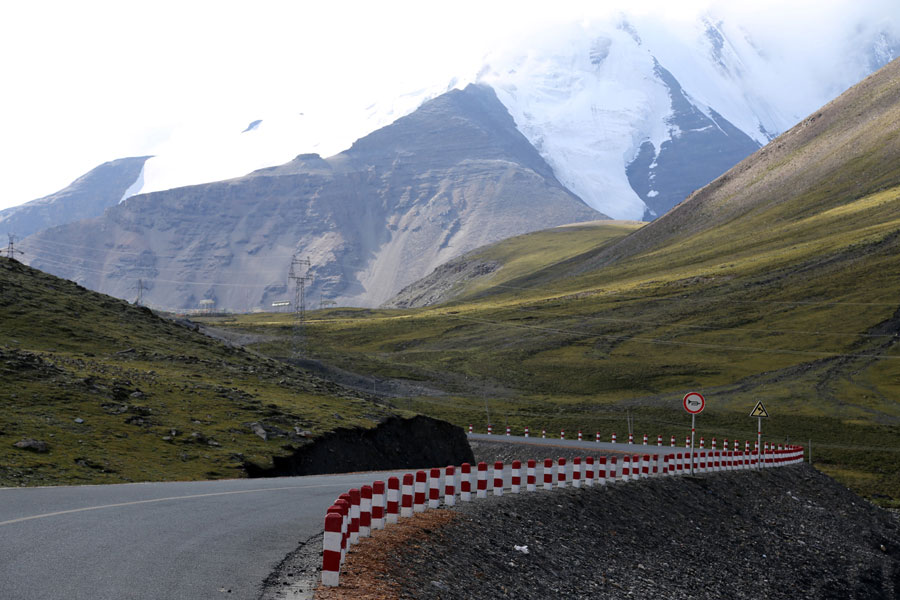
A photo shows the highway below Karuola Glacier in Xigazê, southwest China's Tibet Autonomous Region. [Photo: CRIENGLISH.com/Hu Qi]
A highway transportation network has been completed to connect southwest China's Tibet Autonomous Region with its surrounding areas, which has largely promoted the local traffic conditions.
The transportation network, with Lhasa, capital city of Tibet Autonomous Region as the center, connects southwest China's Sichuan Province, Yunnan Province, northwest China's Xinjiang Uyghur Autonomous Region, west China's Qinghai Province, as well as neighboring countries of India and Nepal to its south.
By the end of 2014, the total highway mileage in Tibet had reached 75,000 kilometers, with 5408 villages, or 99.2 percent of the local villages, accessible to highway transportations.
 |
Day|Week

 The striking moments of Chinese battleship firing
 Largest bullring for Dong people built to accommodate 50,000 people
 Chinese people go crazy about the swimming champion Ning Zetao
 Photos of a BFA sophomore go viral online
 PLA type 96A tanks race in "Tank biathlon" in Moscow
 Marking the 70th anniversary of Hiroshima atomic bombing
 Final of 2015 Miss Weihai Tourism concludes
 Cosplay model at ChinaJoy: photo story
 久久精品视频免费试看
